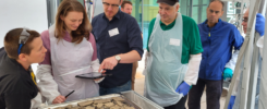
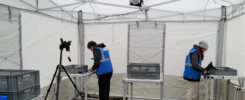
The KulturGutRetter project is developing a workflow to collect and manage data in a seamless manner for the emergency rescue of cultural heritage.
Authors: Elvira Iacono, Research Assistant, and Bernhard Fritsch, Data Manager, German Archaeological Institute – DAI
Also published in: Technical Bulletin #2, June 2023, PROCULTHER-NET.
Emergency rescue of built or movable cultural heritage in the event of a disaster involves the collection of potentially large amounts of information. In order to process this data, the KulturGutRetter project is developing a workflow based on the use of mobile devices for data collection and an easy-to-use system for final data management during response operations. This concept not only takes into account the documentation of movable or immovable cultural heritage, but also the tracking of the processes carried out in the handling of cultural objects in the different rescue phases. In addition, once the fieldwork is completed, the information is then synchronized and processed for further use of the data.
In the KulturGutRetter project, a cooperation between the German Archaeological Institute (DAI), the German Federal Agency for Technical Relief (THW) and the Leibniz Center for Archaeology (LEIZA), various fields of expertise are represented, covering all elements of an emergency response operation: from documenting the damage to the affected cultural heritage, to salvaging the objects, cleaning, restoring or shoring them, and sorting and storing the cultural heritage. Each of these steps generates specific data. The guiding idea is to record all this data in a structured way so that it is possible, at any time, to reconstruct the current condition of an object as well as its condition at the time of salvage.
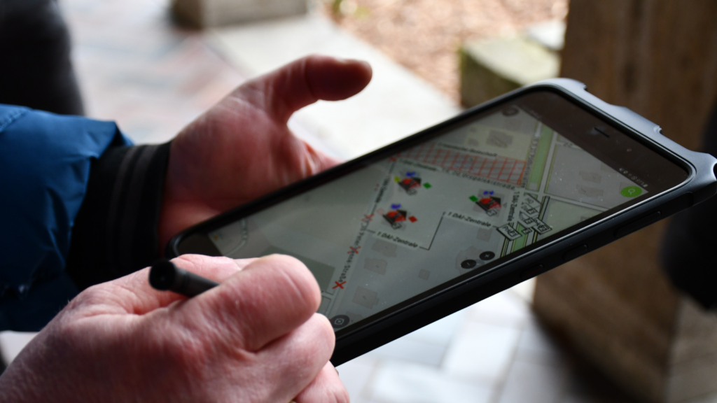
To achieve this goal, the ‘QField’ app is available to meet the needs of the various experts and to ensure the minimum standards required in the event of an emergency. Since QField is basically the mobile tool for the GIS system QGIS, it initially focuses on geodata. However, it is possible for anyone to create their own forms and data models for a specific project, so experts in different fields are satisfied with the possibilities to upload the objects through the app, including not only text-based information, but also photos, audio and video recordings. After the data is recorded on site, it becomes available in the digital documentation software ‘Field Desktop’ for all parties involved. This way, all the information collected during the mission can be handed over in one package or made available online if required.
Necessary conditions
The use of mobile devices in the field must meet certain requirements, both in terms of hardware and software. The mobile devices must be sturdy and yet light and easy to carry and operate, as well as reliable and able to process relatively large amounts of data quickly so that, users can work consistently. To achieve this, the software must also be adapted accordingly, while meeting data entry requirements. Finally, also capable of synchronizing and combining all the data collected into a complete package.
The different work areas of the KulturGutRetter project will take advantage of the opportunities presented by the use of QField in slightly different ways, or will focus on different aspects of the data entry app. Nonetheless, individual datasets will be linked by a common ID system, and in most cases by their geographic data. While linking geospatial data information is the basic function of QField, a specific ID system will be built in parallel, based on the use of UUIDs (Universally Unique Identifier), also including the use of QR codes.
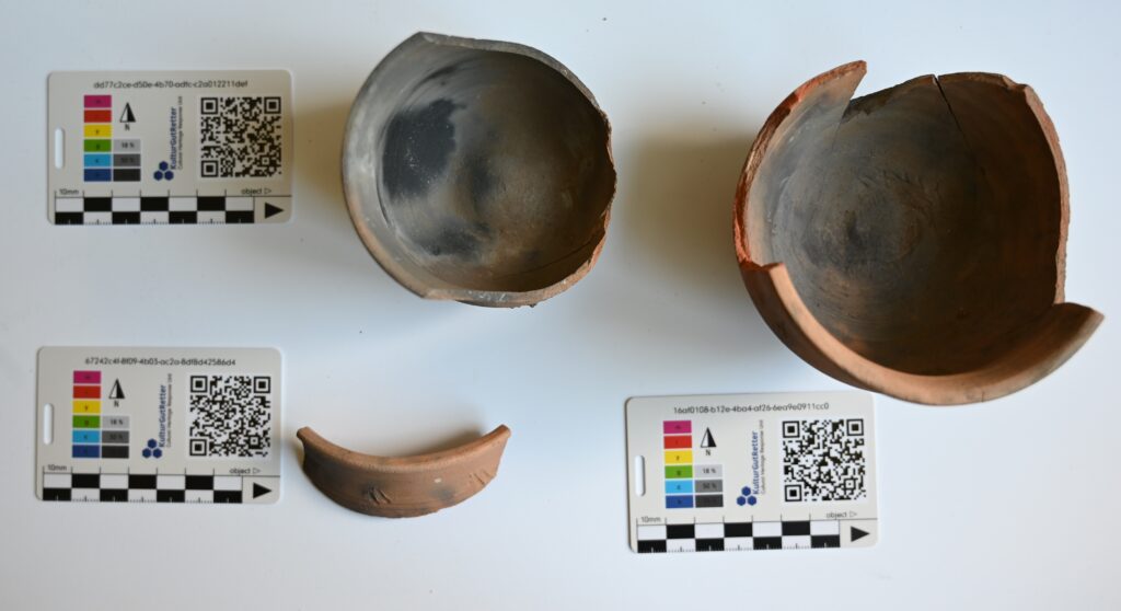
Examples of movable heritage connected to a UUID via QR code | Photo: DAI, Eva Götting-Martin.
As part of the project, a credit card-sized card was developed that can be attached to any movable cultural asset, thus enriching a photo with a (small) scale and a color table. Moreover, via the imprinted UUID – repeated once in plain text and once in the form of a QR code – the object is directly linked to the corresponding data set, which can be accessed by scanning the QR code in the app. In addition to the content designations, immovable cultural heritage is identified uniquely by UUIDs. However, as soon as a conversion from immovable to movable cultural heritage takes place, for example when an architectural piece is recovered, this object is also tagged with a map and a QR code. This system forms the basic framework for unambiguously assigning all objects and data with the help of QField and documenting them in a retrievable manner.
Finally, to store the huge amounts of data and make them easy to understand and use, the documentation system Field Desktop is used. This software was originally developed at the DAI for the documentation of excavations, but has already proven its worth for a wider range of data collection.

Left: interface of QField on a mobile device, right: interface of Field Desktop © Bernhard Fritsch
The system has also recently been used to teach culture professionals in Ukraine how to document endangered immovable heritage. In addition to a reduced view of spatial data, the advantage is good photo management and a clear interface that focuses only on what is necessary – even though much more would be technically possible, but of no greater value in an emergency.
Movable and immovable cultural heritage
The main advantage of the app’s use is the recording of the cultural heritage affected by a disaster. This part is handled by experts trained in different fields, who use different methods and terminologies accordingly. These different backgrounds need to join together and find a common ground in the QField data model, while the experts will also partly work in different forms and tabs, synchronizing each work unit’s data. For the documentation of immovable heritage, it is first and foremost important to map the object under investigation and then to add information about it with further details about damage, condition and the measures that need to be taken to secure the object. Locating and uniquely naming the position at this stage is also critical, as this information will also be used within the app as the basis for locating the movable heritage. The use of drop-down menus or radio buttons as widgets help to dynamically document the actions that are envisioned or have been performed in relation to these objects, and are also a very good tool to avoid spelling errors or number twists. In addition to basic documentation, as per immovable heritage, the app must perform some additional tasks for movable heritage.
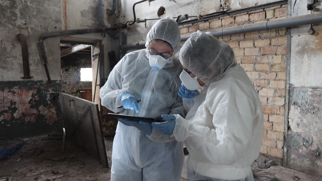
The steps linked to the use of a field laboratory for cleaning and, if necessary, restoring the objects on site must also be documented. Within this workflow, the objects go through different stages (documenting, dry- and/or wet-cleaning, stabilization measures, packing…) where they are treated by different experts. Therefore, the data from each station must be passed on to the next station.
The use of QR codes and the establishment of a local network rely on the infrastructure needed to support the QField. The textual information is entered into forms that are predefined by the various units. These forms are designed to meet standard requirements, but – if really necessary – it is also possible to add fields during the response operation itself, by editing the basic QGIS project, which is then distributed to the mobile devices. In cases where it is not possible to enter text information or when more space is needed, audio and video recordings can also be made and added to the respective record.
Overall, the single dataset contains the same data structure for both types of objects – movable and immovable heritage – and can be stored in a digital project for a response operation. Each object is uniquely identified by a UUID, which can also be displayed as a QR code, and is linked to spatial information to record the closest possible location and track changes in location during the mission. This data structure can be easily exported to other software environments for further use or archiving.
QField
The QField app can be considered as the mobile extension of the open- source geographic information system QGIS (learn more here). This means that all settings and forms to be used in the field using mobile devices with QField installed must be prepared as a single project in QGIS. The project is then transferred to the mobile device where it can be populated with data. To merge all the information from different devices, the project from each device is transferred back to the same QGIS project and can then again be copied to the mobile device, including all the data from the other tablets or smartphones. This workflow can also be simplified by using a cloud solution to synchronize the projects on the different devices simultaneously, but this requires a somewhat more sophisticated infrastructure setup that probably cannot be guaranteed in the field – but should be used whenever possible.
Using a mobile workstation (on which QGIS is installed) as the centerpiece for digital documentation in the field provides an effective way to work with a range of mobile devices and the app QField.
In any case, it is possible to capture data in an offline environment. The main project file can be populated manually via wired connections between the mobile devices and the workstation. When possible, the use of a local network and the ability to synchronize all devices online (i.e., without connecting to the World Wide Web) help to work faster and more accurately, as there is less chance of errors.
Field Desktop
For several years now, the Field Desktop software has been developed within the DAI as a digital documentation system for archaeological excavations. It has been found that Field Desktop also meets all the requirements to create a self-contained data package for safeguarding cultural heritage. The application has recently been translated into Ukrainian and is currently being used to train local experts in the documentation of endangered cultural heritage. The data structure used for field data collection (with QField) can be clearly mapped here, and the program provides strong photo management in conjunction with individual datasets and the corresponding basic spatial information. Like QField, the software is open source, so any third party who receives the data can open and edit it without needing knowledge of working with a complex GIS environment.
Conclusion
Digital tools are an essential part of the overall workflow currently being developed for cultural heritage emergency response as part of the KulturGutRetter project. The advantages are clearly in the fast and accurate acquisition of a large amount of necessary data in a very structured way, so that this data can be easily used, even after the completion of the work in the field. So, the final goal besides obtaining all the necessary information while working on cultural heritage rescue is to have a final data package that can be handed over to the hosting institution and can be easily read and edited by others. The QField app for field work and Field Desktop for data delivery were chosen to implement data collection and management not only because they meet all the technical requirements, but also because they are becoming increasingly popular in the archaeological community.
There is thus a chance that the experts who will participate in the KulturGutRetter project are already familiar with these apps or similar systems. This will also help to speed up procedures in an emergency situation and successfully complete a mission.
Comment
The workflow described here needs the software QGIS with version 3.30 as a minimum requirement in order to use the audio- and video recording functions. Likewise, QField version 2.8 offers new improvements to perform the tasks needed. For both programs an active community keeps constantly developing new versions which will also help to improve the work of the CHRU unit.
Field Desktop offers the Ukrainian language support from version 3.0 and is also been maintained. In order to take pictures with the tablet and an external camera, an extra app is needed for some devices to control the camera remotely since Android 11 due to security reasons by Google.
